|
search place name
|
||
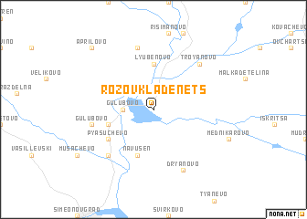
Rozov Kladenets (Bulgaria)Rozov Kladenets is a town in Bulgaria. An overview map of the region around Rozov Kladenets is displayed below.
regional and 3d topo map of Rozov Kladenets, Bulgaria ::
Rozov Kladenets airports ::
The nearest airport is PDV - Plovdiv, located 88.6 km west of Rozov Kladenets.
Other airports nearby include GOZ - Gorna Orechovica Gorna Oryahovitsa (112.5 km north), BOJ - Bourgas Burgas (139.7 km east), AXD - Alexandroupolis Dimokritos (143.8 km south), KVA - Kavala Megas Alexandros Intl (174.9 km south west), Nearby towns ::
Gŭlŭbovo (2.7km west) //
Lyubenovo (5.6km north) //
Navŭsen (5.7km south) //
Gŭlŭbovo (4.5km south west) //
Mitʼo Stanev (5.5km south west) //
Pyasŭchevo (5.5km south west) //
Gŭlŭbovo (5.8km west) //
Konstantinovets (7.5km north) //
Kalugerovo (6.9km south west) //
Troyanovo (6.9km north east) //
Dryanovo (7.9km south) //
Aprilovo (9.2km north west) //
[all distances 'as the bird flies' and approximate] 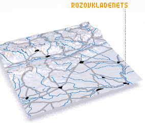 Places with similar names to Rozov Kladenets, Bulgaria :: Disclaimer :: Information on this page comes without warranty of any kind |
||
|
Where is Rozov Kladenets? Elevation and coordinates ::
Latitude (lat): 42°9'0"N Longitude (lon): 25°55'0"E
Elevation (approx.): 112m (map arrows pan, magnifying glasses zoom) |
||
|
Visiting Rozov Kladenets? Hotel/Accommodation ::
Book a hotel in Rozov Kladenets Travel Guide ::
Buy a travel guide for Bulgaria rental cars ::
car rental offers GPS waypoint ::
download a GPX waypoint (PoI) of Rozov Kladenets for your GPS receiver
|
||