|
search place name
|
||
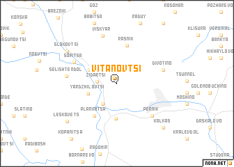
Vitanovtsi (Bulgaria)Vitanovtsi is a town in Bulgaria. An overview map of the region around Vitanovtsi is displayed below.
regional and 3d topo map of Vitanovtsi, Bulgaria ::
Vitanovtsi airports ::
The nearest airport is SOF - Sofia, located 35.1 km east of Vitanovtsi.
Other airports nearby include INI - Nis (119.8 km north west), SKP - Skopje (135.6 km south west), PRN - Pristina (160.0 km west), PDV - Plovdiv (166.8 km east), Nearby towns ::
Meshtitsa (2.6km north east) //
Zidartsi (2.3km west) //
Bogdanovdol (3.7km south west) //
Yardzhilovtsi (3.8km south west) //
Velkovtsi (3.9km north west) //
Bela Voda (5.7km south) //
Rasnik (6.2km north) //
Batanovtsi (5.8km south west) //
Planinitsa (5.8km south west) //
Pernik (6.6km south east) //
Sopitsa (6.1km north west) //
Divotino (5.9km east) //
Viskyar (7.8km north) //
Selishten Dol (6.1km west) //
Slakovtsi (7.8km north west) //
Leskovets (8.5km south west) //
Kalkas (8.9km south east) //
Kopanitsa (10.4km south west) //
[all distances 'as the bird flies' and approximate]  Places with similar names to Vitanovtsi, Bulgaria :: Disclaimer :: Information on this page comes without warranty of any kind |
||
|
Where is Vitanovtsi? Elevation and coordinates ::
Latitude (lat): 42°38'48"N Longitude (lon): 22°58'58"E
Elevation (approx.): 691m (map arrows pan, magnifying glasses zoom) |
||
|
Visiting Vitanovtsi? Hotel/Accommodation ::
Book a hotel in Vitanovtsi Travel Guide ::
Buy a travel guide for Bulgaria rental cars ::
car rental offers GPS waypoint ::
download a GPX waypoint (PoI) of Vitanovtsi for your GPS receiver
|
||