|
search place name
|
||
Cielavas (Dobeles Rajons, Latvia)Cielavas is a town in the Dobeles Rajons region of Latvia. An overview map of the region around Cielavas is displayed below.
regional and 3d topo map of Cielavas, Latvia ::
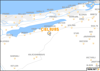
Nearby towns ::
Annasmuiža (2.6km north) //
Klīvji (2.3km north west) //
(( Leiteni )) (4.5km north east) //
Kaupi (3.7km north west) //
Varkaļi (6.3km north) //
Skārduciems (4.5km north east) //
Trenči (4.1km west) //
Dzilnas (5.3km north east) //
Druvciems (7.1km north west) //
(( Avoti )) (8.2km north) //
Majori (8.8km north) //
Dubulti (8.4km north) //
Jūrmala (8.1km north west) //
Kalnciema Masīvs (8.5km south) //
Jaundubulti (8.5km north west) //
Egļu Ciems (8.4km north east) //
(( Mierlauki )) (9.2km south) //
Pumpuri (8.7km north west) //
(( Skreijas )) (7.8km north east) //
Bražas (9.5km north east) //
[all distances 'as the bird flies' and approximate] 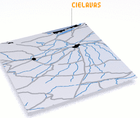 Places with similar names to Cielavas, Latvia ::
Disclaimer :: Information on this page comes without warranty of any kind |
||
|
Where is Cielavas? Elevation and coordinates ::
Latitude (lat): 56°53'40"N Longitude (lon): 23°48'13"E
Elevation (approx.): 8m (map arrows pan, magnifying glasses zoom) |
||
|
Visiting Cielavas? Hotel/Accommodation ::
Book a hotel in Cielavas Travel Guide ::
Buy a travel guide for Latvia rental cars ::
car rental offers GPS waypoint ::
download a GPX waypoint (PoI) of Cielavas for your GPS receiver
|
||