|
search place name
|
||
Jaundiļķi (Talsu Rajons, Latvia)Jaundiļķi is a town in the Talsu Rajons region of Latvia. An overview map of the region around Jaundiļķi is displayed below.
regional and 3d topo map of Jaundiļķi, Latvia ::
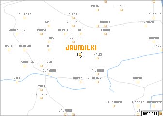
Nearby towns ::
Kaļķi (2.0km east) //
Kurpnieki (3.8km north) //
Piltene (4.2km south east) //
Kārļmuiža (5.6km south) //
Muņi (5.6km north) //
Klāras (5.9km south) //
Pernītes (5.9km north) //
Āži (4.4km north west) //
Rigzemji (7.5km north) //
Lauki (6.3km north east) //
Dundaga (5.4km south west) //
Dūkas (5.4km north west) //
Vaureji (7.7km north) //
Vīdale (8.0km north) //
Grūži (8.4km north west) //
[all distances 'as the bird flies' and approximate] 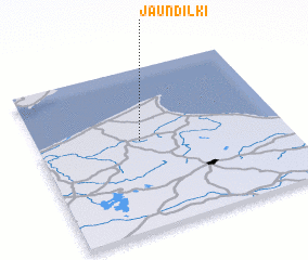 Places with similar names to Jaundiļķi, Latvia ::
Disclaimer :: Information on this page comes without warranty of any kind |
||
|
Where is Jaundiļķi? Elevation and coordinates ::
Latitude (lat): 57°33'0"N Longitude (lon): 22°25'0"E
Elevation (approx.): 81m (map arrows pan, magnifying glasses zoom) |
||
|
Visiting Jaundiļķi? Hotel/Accommodation ::
Book a hotel in Jaundiļķi Travel Guide ::
Buy a travel guide for Latvia rental cars ::
car rental offers GPS waypoint ::
download a GPX waypoint (PoI) of Jaundiļķi for your GPS receiver
|
||