|
search place name
|
||
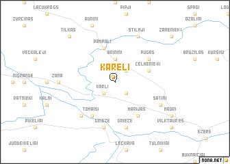
Kareļi (Saldus Rajons, Latvia)Kareļi is a town in the Saldus Rajons region of Latvia. An overview map of the region around Kareļi is displayed below.
regional and 3d topo map of Kareļi, Latvia ::
Kareļi airports ::
The nearest airport is KGD - Kaliningrad Khrabrovo, located 205.2 km south west of Kareļi.
Nearby towns ::
Kārļi (2.1km south west) //
Smilķi (2.1km south east) //
Franči (2.1km north east) //
Briniņi (3.7km north) //
Pampāļi (5.7km north) //
Celmenieki (3.6km north east) //
Tomaiši (5.9km south) //
Marijas (5.9km south) //
Pūgas (4.8km north east) //
Jukšas (4.8km north east) //
Griezė (7.5km south) //
Grieze (7.5km south) //
Grieze (6.4km south west) //
Sātiņi (5.5km south east) //
Stilmji (7.7km north) //
Tilkas (8.5km north west) //
[all distances 'as the bird flies' and approximate] 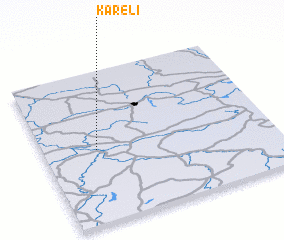 Places with similar names to Kareļi, Latvia ::
Disclaimer :: Information on this page comes without warranty of any kind |
||
|
Where is Kareļi? Elevation and coordinates ::
Latitude (lat): 56°29'0"N Longitude (lon): 22°14'0"E
Elevation (approx.): 81m (map arrows pan, magnifying glasses zoom) |
||
|
Visiting Kareļi? Hotel/Accommodation ::
Book a hotel in Kareļi Travel Guide ::
Buy a travel guide for Latvia rental cars ::
car rental offers GPS waypoint ::
download a GPX waypoint (PoI) of Kareļi for your GPS receiver
|
||