|
search place name
|
||
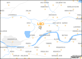
Lāči (Daugavpils Rajons, Latvia)Lāči is a town in the Daugavpils Rajons region of Latvia. An overview map of the region around Lāči is displayed below.
regional and 3d topo map of Lāči, Latvia ::
Nearby towns ::
Kašatņiki (1.9km north) //
Viluši (2.8km south east) //
Hoftenberga (3.8km south) //
Krivāni (2.8km north east) //
Stropi (4.2km south west) //
Križi (3.6km north west) //
Cirši (4.5km north east) //
Zastjenki (4.5km north east) //
Mazkokini (6.4km north east) //
Maļinauka (6.4km north east) //
Tabore (7.7km south) //
Ruģeļi (8.0km south west) //
Zaļumi (8.0km north west) //
Lielkokini (6.9km north east) //
Elkšņi (6.9km south east) //
[all distances 'as the bird flies' and approximate]  Places with similar names to Lāči, Latvia ::
Disclaimer :: Information on this page comes without warranty of any kind |
||
|
Where is Lāči? Elevation and coordinates ::
Latitude (lat): 55°56'0"N Longitude (lon): 26°39'0"E
Elevation (approx.): 116m (map arrows pan, magnifying glasses zoom) |
||
|
Visiting Lāči? Hotel/Accommodation ::
Book a hotel in Lāči Travel Guide ::
Buy a travel guide for Latvia rental cars ::
car rental offers GPS waypoint ::
download a GPX waypoint (PoI) of Lāči for your GPS receiver
|
||