|
search place name
|
||
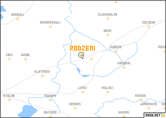
Rodzēni (Valmieras Rajons, Latvia)Rodzēni is a town in the Valmieras Rajons region of Latvia. An overview map of the region around Rodzēni is displayed below.
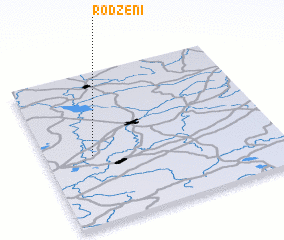
regional and 3d topo map of Rodzēni, Latvia ::
Rodzēni airports ::
The nearest airport is TLL - Tallinn-ulemiste International Tallinn, located 219.7 km north of Rodzēni.
Nearby towns ::
 Places with similar names to Rodzēni, Latvia ::
// Radessen (AT)
// Retznei (AT)
// Raitzen (DE)
// Ratzen (DE)
// Reddighausen (DE)
// Retzen (DE)
// Retzien (DE)
// Retzin (DE)
// Retzin (DE)
// Rotthausen (DE)
Disclaimer :: Information on this page comes without warranty of any kind |
||
|
Where is Rodzēni? Elevation and coordinates ::
Latitude (lat): 57°27'0"N Longitude (lon): 25°12'0"E
Elevation (approx.): 63m (map arrows pan, magnifying glasses zoom) |
||
|
Visiting Rodzēni? Hotel/Accommodation ::
Book a hotel in Rodzēni Travel Guide ::
Buy a travel guide for Latvia rental cars ::
car rental offers GPS waypoint ::
download a GPX waypoint (PoI) of Rodzēni for your GPS receiver
|
||