|
search place name
|
||
Siguļi (Rīgas Rajons, Latvia)Siguļi is a town in the Rīgas Rajons region of Latvia. An overview map of the region around Siguļi is displayed below.
regional and 3d topo map of Siguļi, Latvia ::
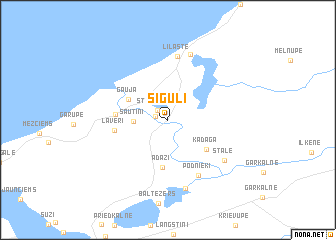
Nearby towns ::
Gaujmala (0.8km north west) //
(( Strēlnieks )) (1.2km north west) //
Sautiņi (2.1km west) //
Gauja (3.3km north west) //
Ādaži (5.4km south) //
Kadaga (4.1km south east) //
Carnikava (3.2km west) //
Laveri (3.4km west) //
Podnieki (6.5km south) //
Lilaste (7.1km north) //
(( Stāle )) (5.7km south east) //
Ezerzviedri (7.5km north) //
Alderi (7.8km south) //
[all distances 'as the bird flies' and approximate] 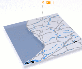 Places with similar names to Siguļi, Latvia ::
Disclaimer :: Information on this page comes without warranty of any kind |
||
|
Where is Siguļi? Elevation and coordinates ::
Latitude (lat): 57°7'26"N Longitude (lon): 24°19'37"E
Elevation (approx.): 4m (map arrows pan, magnifying glasses zoom) |
||
|
Visiting Siguļi? Hotel/Accommodation ::
Book a hotel in Siguļi Travel Guide ::
Buy a travel guide for Latvia rental cars ::
car rental offers GPS waypoint ::
download a GPX waypoint (PoI) of Siguļi for your GPS receiver
|
||