|
search place name
|
||
Stradi (Gulbenes Rajons, Latvia)Stradi is a town in the Gulbenes Rajons region of Latvia. An overview map of the region around Stradi is displayed below.
regional and 3d topo map of Stradi, Latvia ::
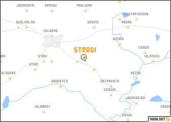
Nearby towns ::
Pāmeri (1.0km west) //
Lejasstradi (2.1km south east) //
Šķieneri (4.0km west) //
Drepis (7.5km north) //
Daukstes (6.3km south west) //
Ostravieši (6.3km south east) //
Antani (5.5km north east) //
Zviedri (8.0km south) //
Gulbene (6.9km north west) //
[all distances 'as the bird flies' and approximate] 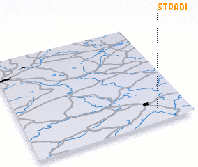 Places with similar names to Stradi, Latvia ::
// Start (RU)
// Staryye Atai (RU)
// Zaouia Taouert (MA)
// Zaouiat Ourti (MA)
// Sterrett (US)
// Strata (US)
// Stroud (US)
// Stuart (US)
// Strad (AT)
// Stuart (US)
Disclaimer :: Information on this page comes without warranty of any kind |
||
|
Where is Stradi? Elevation and coordinates ::
Latitude (lat): 57°8'0"N Longitude (lon): 26°49'0"E
Elevation (approx.): 108m (map arrows pan, magnifying glasses zoom) |
||
|
Visiting Stradi? Hotel/Accommodation ::
Book a hotel in Stradi Travel Guide ::
Buy a travel guide for Latvia rental cars ::
car rental offers GPS waypoint ::
download a GPX waypoint (PoI) of Stradi for your GPS receiver
|
||