|
search place name
|
||
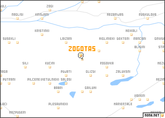
Žogotas (Ludzas Rajons, Latvia)Žogotas is a town in the Ludzas Rajons region of Latvia. An overview map of the region around Žogotas is displayed below.
regional and 3d topo map of Žogotas, Latvia ::
Nearby towns ::
Rasnupļi (0.0km north) //
Zaļmuiža (2.8km north east) //
Glīzdi (3.8km south) //
Laizāni (4.2km north west) //
Pujāti (4.2km south west) //
Rogovka (3.6km south east) //
Miglinieki (4.8km north east) //
Saloši (5.9km south) //
Vecgailumi (4.8km south east) //
Jaungailumi (4.8km south east) //
Čakši (7.4km south) //
Gailumi (7.5km south) //
Kucini (4.5km south west) //
Vietulnieki (6.9km south west) //
Babri (8.0km south) //
[all distances 'as the bird flies' and approximate] 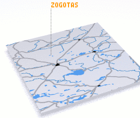 Places with similar names to Žogotas, Latvia ::
Disclaimer :: Information on this page comes without warranty of any kind |
||
|
Where is Žogotas? Elevation and coordinates ::
Latitude (lat): 56°43'0"N Longitude (lon): 27°22'0"E
Elevation (approx.): 128m (map arrows pan, magnifying glasses zoom) |
||
|
Visiting Žogotas? Hotel/Accommodation ::
Book a hotel in Žogotas Travel Guide ::
Buy a travel guide for Latvia rental cars ::
car rental offers GPS waypoint ::
download a GPX waypoint (PoI) of Žogotas for your GPS receiver
|
||