|
search place name
|
||
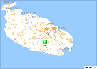
Tas-Samra (Malta)Tas-Samra is a town in Malta. An overview map of the region around Tas-Samra is displayed below.
regional and 3d topo map of Tas-Samra, Malta ::
Tas-Samra airports ::
The nearest airport is MLA - Malta Luqa, located 3.2 km south of Tas-Samra.
Other airports nearby include NSY - Sigonella (172.7 km north), LMP - Lampedusa (174.8 km west), CTA - Catania Fontanarossa (183.0 km north), Nearby towns ::
Tad-Duluri (0.4km north) //
Ħamrun (0.5km west) //
Gwardamanġa (0.7km north) //
Marsa (0.7km south east) //
Msida (1.1km north west) //
Pietà (1.2km north) //
Taʼ Ċeppuna (1.2km south) //
Misraħ Il-Barrieri (1.3km north) //
L-Ingiered (1.4km south) //
L-Istabar (1.3km south west) //
Tad-Dwieli (1.3km west) //
Paola (1.5km south east) //
Tal-Qtates (1.7km south) //
Għammieri (1.6km south west) //
Taʼ Xbiex (1.7km north) //
Kordin (1.5km east) //
Tal-Ħriereb (1.8km north) //
Msieraħ (1.8km north) //
Santa Vennera (1.6km north west) //
Is-Swatar (1.8km north west) //
Tal-Palazz l-Aħmar (1.7km west) //
Il- Gżira (1.9km north east) //
Qormi (1.8km west) //
Corradino Heights (1.8km east) //
Fleur de Lys (2.0km north west) //
Ħal Saflieni (2.1km south east) //
Il-Furjana (2.1km north east) //
L-Armier (2.0km south west) //
Il-Gżira (2.4km north) //
[all distances 'as the bird flies' and approximate] 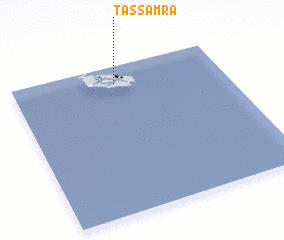 Places with similar names to Tas-Samra, Malta ::
Disclaimer :: Information on this page comes without warranty of any kind |
||
|
Where is Tas-Samra? Elevation and coordinates ::
Latitude (lat): 35°53'4"N Longitude (lon): 14°29'25"E
Elevation (approx.): 28m (map arrows pan, magnifying glasses zoom) |
||
|
Visiting Tas-Samra? Hotel/Accommodation ::
Book a hotel in Tas-Samra Travel Guide ::
Buy a travel guide for Malta rental cars ::
car rental offers GPS waypoint ::
download a GPX waypoint (PoI) of Tas-Samra for your GPS receiver
|
||