|
search place name
|
||
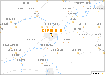
Alba Iulia (Alba, Romania)Alba Iulia is a town in the Alba region of Romania. An overview map of the region around Alba Iulia is displayed below.
regional and 3d topo map of Alba Iulia, Romania ::
Alba Iulia airports ::
The nearest airport is SBZ - Sibiu, located 50.3 km south east of Alba Iulia.
Other airports nearby include TGM - Tirgu Mures Vidrasau (77.9 km north east), CLJ - Cluj-napoca Cluj Napoca (80.3 km north), CSB - Caransebes (126.0 km south west), OMR - Oradea (167.2 km north west), Nearby towns ::
Drîmbar (2.3km north east) //
Partoş (2.3km south west) //
Părîu Iovului (3.7km north) //
Bărăbanţ (3.7km north) //
Blidăreşti (3.9km north) //
Oarda de Jos (3.9km south) //
Limba (3.9km south) //
Ciugud (3.2km south east) //
Miceşti (4.5km north west) //
Oarda de Sus (5.7km south) //
Şeuşa (4.3km south east) //
Pîclişa (5.5km west) //
Şard (8.4km north west) //
Totoiu (7.6km north east) //
Sîntimbru (9.0km north east) //
[all distances 'as the bird flies' and approximate] 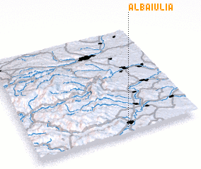 Places with similar names to Alba Iulia, Romania ::
Disclaimer :: Information on this page comes without warranty of any kind |
||
|
Where is Alba Iulia? Elevation and coordinates ::
Latitude (lat): 46°4'0"N Longitude (lon): 23°35'0"E
Elevation (approx.): 218m (map arrows pan, magnifying glasses zoom) |
||
|
Visiting Alba Iulia? Hotel/Accommodation ::
Book a hotel in Alba Iulia Travel Guide ::
Buy a travel guide for Romania rental cars ::
car rental offers GPS waypoint ::
download a GPX waypoint (PoI) of Alba Iulia for your GPS receiver
|
||