|
search place name
|
||
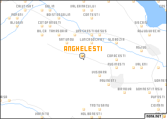
Angheleşti (Covurlui, Romania)Angheleşti is a town in the Covurlui region of Romania. An overview map of the region around Angheleşti is displayed below.
regional and 3d topo map of Angheleşti, Romania ::
Angheleşti airports ::
The nearest airport is BCM - Bacau, located 49.9 km north of Angheleşti.
Other airports nearby include IAS - Iasi (129.3 km north), KIV - Kichinau Fir/acc/com Chisinau Intl (172.2 km north east), TCE - Tulcea Cataloi (172.5 km south east), OTP - Bucharest Henri Coanda (183.6 km south west), Nearby towns ::
Lunca Dochiei (3.9km north) //
Viişoara (4.5km south east) //
Satu Nou (4.5km north west) //
Urecheştii de Sus (5.7km north) //
Cornăţel (5.7km north) //
Urecheşti (6.1km north east) //
Copăceşti (5.1km east) //
Rugineşti (5.5km east) //
Păuneşti (6.8km south east) //
Tămăşoaia (6.8km north west) //
Slobozia (6.3km north east) //
Coţofăneşti (9.0km north west) //
Boiştea de Jos (9.0km north west) //
[all distances 'as the bird flies' and approximate] 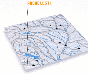 Places with similar names to Angheleşti, Romania ::
Disclaimer :: Information on this page comes without warranty of any kind |
||
|
Where is Angheleşti? Elevation and coordinates ::
Latitude (lat): 46°5'0"N Longitude (lon): 27°3'0"E
Elevation (approx.): 259m (map arrows pan, magnifying glasses zoom) |
||
|
Visiting Angheleşti? Hotel/Accommodation ::
Book a hotel in Angheleşti Travel Guide ::
Buy a travel guide for Romania rental cars ::
car rental offers GPS waypoint ::
download a GPX waypoint (PoI) of Angheleşti for your GPS receiver
|
||