|
search place name
|
||
Blahniţa de Jos (Covurlui, Romania)Blahniţa de Jos is a town in the Covurlui region of Romania. An overview map of the region around Blahniţa de Jos is displayed below.
regional and 3d topo map of Blahniţa de Jos, Romania ::

Blahniţa de Jos airports ::
The nearest airport is CRA - Craiova, located 81.3 km south of Blahniţa de Jos.
Other airports nearby include SBZ - Sibiu (98.2 km north east), CSB - Caransebes (109.7 km north west), TGM - Tirgu Mures Vidrasau (177.4 km north east), CLJ - Cluj-napoca Cluj Napoca (198.9 km north), Nearby towns ::
Colibaşi (2.3km north east) //
Bobu (3.7km north) //
Cîmpu Mare (3.9km north) //
Comăneşti (3.9km south) //
Raba (3.9km north) //
Cojani (3.2km south east) //
Pojogeni (3.2km south west) //
Ungurelu (4.5km south east) //
Tîrgu Cărbuneşti (5.6km south) //
Mogoşani (5.6km north) //
Doseni (3.9km east) //
Rogojeni (5.7km south) //
Cerătu (4.3km south west) //
Ştefăneşti (4.3km south east) //
Lazuri (5.4km north west) //
Duţeşti (6.1km south east) //
Cărbuneşti-Sat (6.1km south east) //
Bolboceşti (5.2km east) //
Cionteşti (7.5km south) //
Hăieşti (7.5km north) //
Pîrîu Boia (7.5km south) //
Rugi (5.6km west) //
Scoarţa (5.6km west) //
Mirosloveni (6.4km north east) //
Tupşani (7.9km south) //
Măceşu (8.4km south west) //
Curteana (7.6km south west) //
[all distances 'as the bird flies' and approximate] 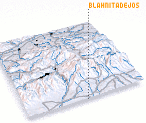 Places with similar names to Blahniţa de Jos, Romania :: Disclaimer :: Information on this page comes without warranty of any kind |
||
|
Where is Blahniţa de Jos? Elevation and coordinates ::
Latitude (lat): 45°0'0"N Longitude (lon): 23°31'0"E
Elevation (approx.): 229m (map arrows pan, magnifying glasses zoom) |
||
|
Visiting Blahniţa de Jos? Hotel/Accommodation ::
Book a hotel in Blahniţa de Jos Travel Guide ::
Buy a travel guide for Romania rental cars ::
car rental offers GPS waypoint ::
download a GPX waypoint (PoI) of Blahniţa de Jos for your GPS receiver
|
||