|
search place name
|
||
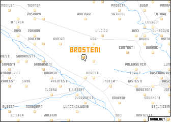
Broşteni (Covurlui, Romania)Broşteni is a town in the Covurlui region of Romania. An overview map of the region around Broşteni is displayed below.
regional and 3d topo map of Broşteni, Romania ::
Broşteni airports ::
The nearest airport is SCV - Suceava Stefan Cel Mare, located 46.0 km north of Broşteni.
Other airports nearby include IAS - Iasi (80.9 km east), BCM - Bacau (90.4 km south), Nearby towns ::
Homiţa (1.3km east) //
Cristeşti (3.7km south) //
Hereşti (3.9km south) //
Uda (3.9km north) //
Ţigluia (3.9km north) //
Leordişu (3.9km north) //
Iorcani (5.3km north west) //
Vîlcica (6.1km north east) //
Pietrosu (6.1km north east) //
Tătăruşi (6.1km north east) //
Timişeşti (7.5km south) //
Preuteşti (6.7km south west) //
Moţca (6.7km south east) //
Ungheni (6.2km south west) //
Plăeşu (9.0km south west) //
[all distances 'as the bird flies' and approximate] 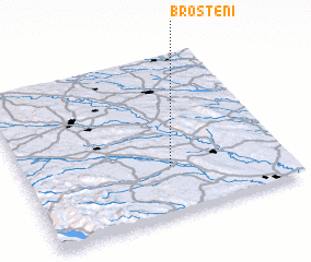 Places with similar names to Broşteni, Romania ::
Disclaimer :: Information on this page comes without warranty of any kind |
||
|
Where is Broşteni? Elevation and coordinates ::
Latitude (lat): 47°18'0"N Longitude (lon): 26°34'0"E
Elevation (approx.): 342m (map arrows pan, magnifying glasses zoom) |
||
|
Visiting Broşteni? Hotel/Accommodation ::
Book a hotel in Broşteni Travel Guide ::
Buy a travel guide for Romania rental cars ::
car rental offers GPS waypoint ::
download a GPX waypoint (PoI) of Broşteni for your GPS receiver
|
||