|
search place name
|
||
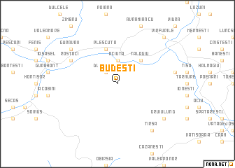
Budeşti (Covurlui, Romania)Budeşti is a town in the Covurlui region of Romania. An overview map of the region around Budeşti is displayed below.
regional and 3d topo map of Budeşti, Romania ::
Budeşti airports ::
The nearest airport is ARW - Arad, located 92.0 km west of Budeşti.
Other airports nearby include CSB - Caransebes (93.5 km south), OMR - Oradea (95.8 km north west), TSR - Timisoara Traian Vuia (99.0 km south west), CLJ - Cluj-napoca Cluj Napoca (112.0 km north east), Nearby towns ::
Dumbrava (2.3km north west) //
Aciuţa (3.7km north) //
Tălagiu (4.5km north east) //
Pleşcuţa (5.7km north) //
Rostoci (6.3km north west) //
Gura Văii (7.6km north west) //
Gruiu Lung (7.6km south east) //
Măgura (8.4km south east) //
Ciungani (8.4km south east) //
Bălacia (8.4km south east) //
Tîrsa (8.4km south east) //
Vîrfurile (9.0km north east) //
[all distances 'as the bird flies' and approximate]  Places with similar names to Budeşti, Romania ::
// Bautista (PH)
// Bautista (PH)
// Bautista (PH)
// Bautista (PH)
// Bautista (PH)
// Butte City (US)
// Butte City (US)
// Båtstø (NO)
// Biedźiadów (PL)
// Batista (CU)
Disclaimer :: Information on this page comes without warranty of any kind |
||
|
Where is Budeşti? Elevation and coordinates ::
Latitude (lat): 46°15'0"N Longitude (lon): 22°27'0"E
Elevation (approx.): 475m (map arrows pan, magnifying glasses zoom) |
||
|
Visiting Budeşti? Hotel/Accommodation ::
Book a hotel in Budeşti Travel Guide ::
Buy a travel guide for Romania rental cars ::
car rental offers GPS waypoint ::
download a GPX waypoint (PoI) of Budeşti for your GPS receiver
|
||