|
search place name
|
||
Câmpurelu (Giurgiu, Romania)Câmpurelu is a town in the Giurgiu region of Romania. An overview map of the region around Câmpurelu is displayed below.
regional and 3d topo map of Câmpurelu, Romania ::

Câmpurelu airports ::
The nearest airport is BBU - Bucharest Aurel Vlaicu, located 30.8 km north of Câmpurelu.
Other airports nearby include OTP - Bucharest Henri Coanda (38.3 km north), GOZ - Gorna Orechovica Gorna Oryahovitsa (126.0 km south), VAR - Varna (172.7 km south east), BOJ - Bourgas Burgas (213.9 km south east), Nearby towns ::
Vidra (3.3km north) //
Colibaşi (3.5km south) //
Grădiştea (3.0km south west) //
Falaştoaca (3.8km south) //
Dobreni (3.2km north east) //
Bragadiru (4.0km north) //
Goştinari-Văcăreşti (6.1km south east) //
Vărăşti (5.2km east) //
Creţeşti (6.2km north west) //
Obedeni (5.5km east) //
Goştinari-Belu (6.8km south east) //
Sbârcea (7.0km north west) //
Comana (7.6km south west) //
Mogoşeşti (6.0km west) //
Budeni (7.5km south west) //
Mioneşti (8.5km south east) //
Sinteşti (9.4km north west) //
[all distances 'as the bird flies' and approximate] 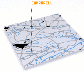 Places with similar names to Câmpurelu, Romania ::
// Campo Real (ES)
// Comprol (IN)
// Camporal (MX)
// Quimperlé (FR)
// Camporeale (IT)
// Campo Real (BR)
Disclaimer :: Information on this page comes without warranty of any kind |
||
|
Where is Câmpurelu? Elevation and coordinates ::
Latitude (lat): 44°13'58"N Longitude (lon): 26°11'3"E
Elevation (approx.): 49m (map arrows pan, magnifying glasses zoom) |
||
|
Visiting Câmpurelu? Hotel/Accommodation ::
Book a hotel in Câmpurelu Travel Guide ::
Buy a travel guide for Romania rental cars ::
car rental offers GPS waypoint ::
download a GPX waypoint (PoI) of Câmpurelu for your GPS receiver
|
||