|
search place name
|
||
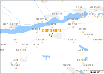
Darabani (Covurlui, Romania)Darabani is a town in the Covurlui region of Romania. An overview map of the region around Darabani is displayed below.
regional and 3d topo map of Darabani, Romania ::
Darabani airports ::
The nearest airport is SCV - Suceava Stefan Cel Mare, located 57.7 km south of Darabani.
Other airports nearby include IAS - Iasi (136.2 km south east), BCM - Bacau (186.4 km south), Nearby towns ::
Corneşti (2.2km north east) //
Teioasa (3.7km north) //
Conceşti (3.1km south west) //
Bajura (4.1km north west) //
Negrintsy (6.1km north west) //
Vatra (5.2km south west) //
Eşanca (5.3km east) //
Mamalyga (7.5km north) //
Păltiniş (6.2km north east) //
Ivăncăuţi (7.4km north east) //
[all distances 'as the bird flies' and approximate] 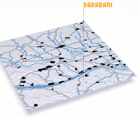 Places with similar names to Darabani, Romania ::
Disclaimer :: Information on this page comes without warranty of any kind |
||
|
Where is Darabani? Elevation and coordinates ::
Latitude (lat): 48°11'0"N Longitude (lon): 26°35'0"E
Elevation (approx.): 222m (map arrows pan, magnifying glasses zoom) |
||
|
Visiting Darabani? Hotel/Accommodation ::
Book a hotel in Darabani Travel Guide ::
Buy a travel guide for Romania rental cars ::
car rental offers GPS waypoint ::
download a GPX waypoint (PoI) of Darabani for your GPS receiver
|
||