|
search place name
|
||
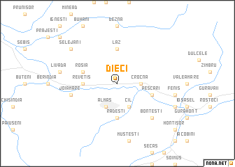
Dieci (Covurlui, Romania)Dieci is a town in the Covurlui region of Romania. An overview map of the region around Dieci is displayed below.
regional and 3d topo map of Dieci, Romania ::
Dieci airports ::
The nearest airport is ARW - Arad, located 77.8 km west of Dieci.
Other airports nearby include OMR - Oradea (83.1 km north), TSR - Timisoara Traian Vuia (90.3 km south west), CSB - Caransebes (99.7 km south), CLJ - Cluj-napoca Cluj Napoca (121.8 km north east), Nearby towns ::
Crocna (2.6km east) //
Almaş (3.9km south) //
Cil (3.9km south) //
Rădeşti (5.6km south) //
Revetiş (3.8km west) //
Laz (5.6km north) //
Roşia (4.3km north west) //
Pescari (4.3km south east) //
Joia Mare (5.4km west) //
Cociuba (5.4km west) //
Bonţeşti (6.8km south east) //
Selejani (7.6km north west) //
[all distances 'as the bird flies' and approximate] 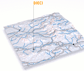 Places with similar names to Dieci, Romania ::
Disclaimer :: Information on this page comes without warranty of any kind |
||
|
Where is Dieci? Elevation and coordinates ::
Latitude (lat): 46°19'0"N Longitude (lon): 22°15'0"E
Elevation (approx.): 172m (map arrows pan, magnifying glasses zoom) |
||
|
Visiting Dieci? Hotel/Accommodation ::
Book a hotel in Dieci Travel Guide ::
Buy a travel guide for Romania rental cars ::
car rental offers GPS waypoint ::
download a GPX waypoint (PoI) of Dieci for your GPS receiver
|
||