|
search place name
|
||
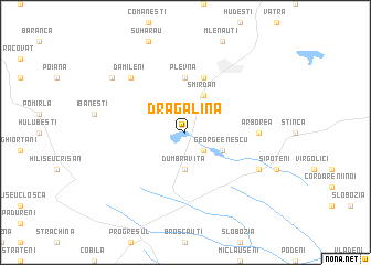
Dragalina (Covurlui, Romania)Dragalina is a town in the Covurlui region of Romania. An overview map of the region around Dragalina is displayed below.
regional and 3d topo map of Dragalina, Romania ::
Dragalina airports ::
The nearest airport is SCV - Suceava Stefan Cel Mare, located 40.9 km south of Dragalina.
Other airports nearby include IAS - Iasi (130.9 km south east), BCM - Bacau (173.4 km south), Nearby towns ::
Popeni (2.2km south east) //
Dumbrăviţa (3.7km south) //
George Enescu (3.1km south east) //
Smîrdan (3.9km north) //
Plevna (5.6km north) //
Lişna (5.7km north) //
Arborea (5.0km east) //
Dămileni (6.7km north west) //
Cracalia (6.2km south east) //
Cristineşti (7.4km north west) //
[all distances 'as the bird flies' and approximate] 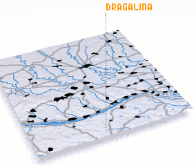 Places with similar names to Dragalina, Romania ::
Disclaimer :: Information on this page comes without warranty of any kind |
||
|
Where is Dragalina? Elevation and coordinates ::
Latitude (lat): 48°3'0"N Longitude (lon): 26°27'0"E
Elevation (approx.): 177m (map arrows pan, magnifying glasses zoom) |
||
|
Visiting Dragalina? Hotel/Accommodation ::
Book a hotel in Dragalina Travel Guide ::
Buy a travel guide for Romania rental cars ::
car rental offers GPS waypoint ::
download a GPX waypoint (PoI) of Dragalina for your GPS receiver
|
||