|
search place name
|
||
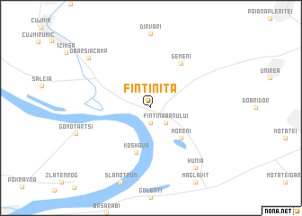
Fîntîniţa (Covurlui, Romania)Fîntîniţa is a town in the Covurlui region of Romania. An overview map of the region around Fîntîniţa is displayed below.
regional and 3d topo map of Fîntîniţa, Romania ::
Fîntîniţa airports ::
The nearest airport is CRA - Craiova, located 70.7 km east of Fîntîniţa.
Other airports nearby include INI - Nis (129.6 km south west), CSB - Caransebes (158.0 km north west), SOF - Sofia (160.5 km south), SBZ - Sibiu (202.9 km north east), Nearby towns ::
Cetate (1.9km south) //
Fîntîna Banului (2.3km south east) //
Moreni (4.6km south east) //
Koshava (5.7km south) //
Gemeni (6.2km north east) //
Hunia (8.4km south east) //
Obârşia-Câmp (8.3km north west) //
[all distances 'as the bird flies' and approximate]  Places with similar names to Fîntîniţa, Romania ::
// Fontanet (US)
// Vino Tinto (PA)
// Vino Tinto (PA)
// Fontaneda (AD)
// Fîntîniţa (RO)
// Fontenot (US)
// Fandanda (GN)
// Fandanta (GN)
// Fontenet (FR)
// Fontenotte (FR)
Disclaimer :: Information on this page comes without warranty of any kind |
||
|
Where is Fîntîniţa? Elevation and coordinates ::
Latitude (lat): 44°7'0"N Longitude (lon): 23°3'0"E
Elevation (approx.): 82m (map arrows pan, magnifying glasses zoom) |
||
|
Visiting Fîntîniţa? Hotel/Accommodation ::
Book a hotel in Fîntîniţa Travel Guide ::
Buy a travel guide for Romania rental cars ::
car rental offers GPS waypoint ::
download a GPX waypoint (PoI) of Fîntîniţa for your GPS receiver
|
||