|
search place name
|
||
Hîrleşti (Covurlui, Romania)Hîrleşti is a town in the Covurlui region of Romania. An overview map of the region around Hîrleşti is displayed below.
regional and 3d topo map of Hîrleşti, Romania ::

Hîrleşti airports ::
The nearest airport is BCM - Bacau, located 32.8 km south of Hîrleşti.
Other airports nearby include IAS - Iasi (69.0 km north east), SCV - Suceava Stefan Cel Mare (104.8 km north), TCE - Tulcea Cataloi (241.2 km south east), Nearby towns ::
Şerbăneşti (1.9km south) //
Onişcani (2.2km south west) //
Mirceşti (3.9km north) //
Aldeşti (3.9km south) //
Onişcani-Tîrg (3.9km south) //
Gorovei (3.8km east) //
Sofrăceşti (5.7km north) //
Boanta (5.7km south) //
Icuseşti (4.2km south east) //
Başta (5.7km north) //
Secueni (5.3km north west) //
Secuenii Noi (5.3km north west) //
Onişcani-Sat (6.1km south east) //
Corneşti (6.1km south east) //
Spiridoneşti (5.3km south east) //
Filipeşti (7.4km south) //
Rediu (7.5km north) //
Cîrligi (6.7km south west) //
Căciulaţi (6.3km north west) //
Liliac (6.3km south west) //
Recea (6.3km north east) //
Cotu lui Bălan (6.3km north east) //
Arămeşti-Răzeşi (7.5km south west) //
Arămeşti-Boereşti (7.5km south west) //
Arămeşti (7.5km south west) //
Buciumi-Precista (8.3km south west) //
[all distances 'as the bird flies' and approximate] 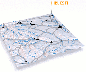 Places with similar names to Hîrleşti, Romania ::
Disclaimer :: Information on this page comes without warranty of any kind |
||
|
Where is Hîrleşti? Elevation and coordinates ::
Latitude (lat): 46°49'0"N Longitude (lon): 26°53'0"E
Elevation (approx.): 172m (map arrows pan, magnifying glasses zoom) |
||
|
Visiting Hîrleşti? Hotel/Accommodation ::
Book a hotel in Hîrleşti Travel Guide ::
Buy a travel guide for Romania rental cars ::
car rental offers GPS waypoint ::
download a GPX waypoint (PoI) of Hîrleşti for your GPS receiver
|
||