|
search place name
|
||
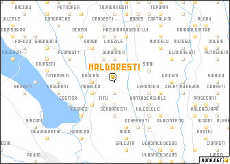
Măldăreşti (Covurlui, Romania)Măldăreşti is a town in the Covurlui region of Romania. An overview map of the region around Măldăreşti is displayed below.
regional and 3d topo map of Măldăreşti, Romania ::
Măldăreşti airports ::
The nearest airport is BCM - Bacau, located 44.4 km north west of Măldăreşti.
Other airports nearby include IAS - Iasi (110.0 km north), KIV - Kichinau Fir/acc/com Chisinau Intl (149.0 km north east), TCE - Tulcea Cataloi (170.0 km south east), SCV - Suceava Stefan Cel Mare (178.2 km north west), Nearby towns ::
Neguleşti (1.9km north) //
Lărgăşeni (1.9km south) //
Perchiu (2.6km west) //
Dumbrava (3.7km north) //
Rădăcineşti (3.7km south) //
Căpoteşti (3.9km north) //
Nedelcu (3.2km south west) //
Ţîţu (3.9km south) //
Găleşti (4.5km south west) //
Prădaiş (4.5km south west) //
Şerbăneşti (5.6km south) //
Blaga (5.6km north) //
Livezile (5.6km north) //
Sîrbi (4.3km north east) //
Lehancea (4.3km south east) //
Şarba (6.1km north west) //
Hurueşti (6.1km north west) //
Hanţa de pe Deal (5.3km south east) //
Hanţa de pe Vale (5.3km south east) //
Hanţa (5.3km south east) //
Căuia (7.4km north) //
Căuia de Sus (7.5km north) //
Hazu Moara Dediului (7.5km north) //
Corbiţa (7.5km south) //
Bălăneşti (5.5km east) //
Lespezi (6.8km south west) //
Vîlcelele (6.8km south east) //
Floreşti (6.3km north west) //
Costişa (6.3km south west) //
[all distances 'as the bird flies' and approximate] 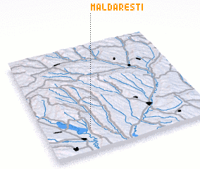 Places with similar names to Măldăreşti, Romania ::
Disclaimer :: Information on this page comes without warranty of any kind |
||
|
Where is Măldăreşti? Elevation and coordinates ::
Latitude (lat): 46°13'0"N Longitude (lon): 27°17'0"E
Elevation (approx.): 211m (map arrows pan, magnifying glasses zoom) |
||
|
Visiting Măldăreşti? Hotel/Accommodation ::
Book a hotel in Măldăreşti Travel Guide ::
Buy a travel guide for Romania rental cars ::
car rental offers GPS waypoint ::
download a GPX waypoint (PoI) of Măldăreşti for your GPS receiver
|
||