|
search place name
|
||
Merfuleşti (Covurlui, Romania)Merfuleşti is a town in the Covurlui region of Romania. An overview map of the region around Merfuleşti is displayed below.
regional and 3d topo map of Merfuleşti, Romania ::

Merfuleşti airports ::
The nearest airport is CRA - Craiova, located 82.2 km south east of Merfuleşti.
Other airports nearby include CSB - Caransebes (100.8 km north west), SBZ - Sibiu (109.5 km north east), TGM - Tirgu Mures Vidrasau (187.9 km north east), CLJ - Cluj-napoca Cluj Napoca (205.6 km north), Nearby towns ::
Barza (1.9km north) //
Lazu (1.9km south) //
Brătuia (1.9km south) //
Dăneşti (2.3km north west) //
Brătuia (2.3km south east) //
Ţîrculeşti (2.3km south west) //
Urzica (3.7km north) //
Saşa (3.7km north) //
Ungureni (3.7km north) //
Arţaru (3.9km north) //
Trocani (3.2km south east) //
Văcarea (3.2km north west) //
Uşurei (4.3km north west) //
Botorogi (5.4km north west) //
Bucureasa (6.1km north west) //
Floreşteni (5.6km east) //
Moneşti (7.5km north) //
Bălticel Andrei (6.8km north east) //
Budieni (7.9km north) //
Răşina (7.9km south) //
Ţicleni (8.4km south east) //
[all distances 'as the bird flies' and approximate] 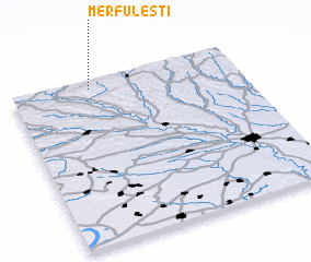 Places with similar names to Merfuleşti, Romania :: Disclaimer :: Information on this page comes without warranty of any kind |
||
|
Where is Merfuleşti? Elevation and coordinates ::
Latitude (lat): 44°57'0"N Longitude (lon): 23°21'0"E
Elevation (approx.): 295m (map arrows pan, magnifying glasses zoom) |
||
|
Visiting Merfuleşti? Hotel/Accommodation ::
Book a hotel in Merfuleşti Travel Guide ::
Buy a travel guide for Romania rental cars ::
car rental offers GPS waypoint ::
download a GPX waypoint (PoI) of Merfuleşti for your GPS receiver
|
||