|
search place name
|
||
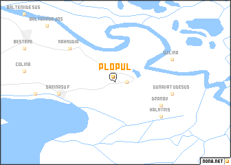
Plopul (Covurlui, Romania)Plopul is a town in the Covurlui region of Romania. An overview map of the region around Plopul is displayed below.
regional and 3d topo map of Plopul, Romania ::
Plopul airports ::
The nearest airport is TCE - Tulcea Cataloi, located 34.5 km west of Plopul.
Other airports nearby include CND - Constanta Mihail Kogalniceanu (91.2 km south west), ODS - Odessa Odesa Intl (195.2 km north east), KIV - Kichinau Fir/acc/com Chisinau Intl (211.2 km north), VAR - Varna (226.5 km south west), Nearby towns ::
Murighiol (1.3km east) //
Dranov (6.4km south east) //
Mahmudia (7.6km north west) //
Dunavăţu de Jos (7.6km south east) //
Halmyris (7.6km south east) //
[all distances 'as the bird flies' and approximate] 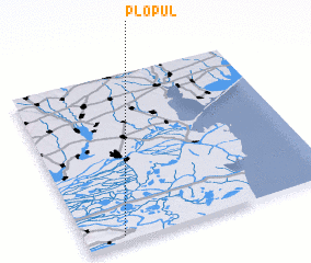 Places with similar names to Plopul, Romania ::
// Pliopliai (LT)
// Pillapalu (EE)
// Plēpļi (LV)
// Pouloupoulou (BF)
// Palpal (CL)
// Pilipili (CD)
// Pilipili (CD)
// Pole-Pole (CD)
// Pillipalli (IN)
// Pulapalli (IN)
Disclaimer :: Information on this page comes without warranty of any kind |
||
|
Where is Plopul? Elevation and coordinates ::
Latitude (lat): 45°2'0"N Longitude (lon): 29°9'0"E
(map arrows pan, magnifying glasses zoom) |
||
|
Visiting Plopul? Hotel/Accommodation ::
Book a hotel in Plopul Travel Guide ::
Buy a travel guide for Romania rental cars ::
car rental offers GPS waypoint ::
download a GPX waypoint (PoI) of Plopul for your GPS receiver
|
||