|
search place name
|
||
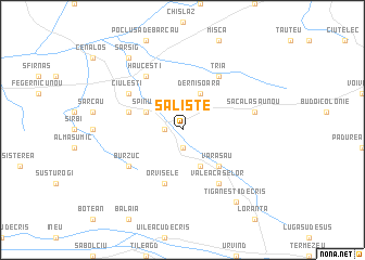
Sălişte (Covurlui, Romania)Sălişte is a town in the Covurlui region of Romania. An overview map of the region around Sălişte is displayed below.
regional and 3d topo map of Sălişte, Romania ::
Sălişte airports ::
The nearest airport is OMR - Oradea, located 30.6 km south west of Sălişte.
Other airports nearby include DEB - Debrecen (57.8 km north west), SUJ - Satu Mare (75.9 km north east), BAY - Baia Mare Tautii Magheraus (107.2 km north east), CLJ - Cluj-napoca Cluj Napoca (119.1 km east), Nearby towns ::
Păuleşti (1.9km south) //
Gurbeşti (1.3km west) //
Brusturi (3.9km south) //
Spinuş (3.1km north west) //
Dernişoara (3.9km north) //
Varasău (4.5km south east) //
Orvişele (5.7km south) //
Nădar (4.2km north west) //
Hăuceşti (6.1km north west) //
Burzuc (5.3km south west) //
Tria (6.1km north east) //
Ciuleşti (5.3km north west) //
Picleu (6.1km south east) //
Valea Caselor (6.1km south east) //
Derna (5.4km east) //
Săcălăşău Nou (5.4km east) //
Săcălăşău (5.4km east) //
Ţigăneştii de Criş (8.3km south east) //
Sărsig (8.3km north west) //
[all distances 'as the bird flies' and approximate] 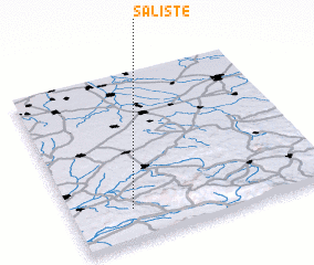 Places with similar names to Sălişte, Romania ::
Disclaimer :: Information on this page comes without warranty of any kind |
||
|
Where is Sălişte? Elevation and coordinates ::
Latitude (lat): 47°11'0"N Longitude (lon): 22°14'0"E
Elevation (approx.): 169m (map arrows pan, magnifying glasses zoom) |
||
|
Visiting Sălişte? Hotel/Accommodation ::
Book a hotel in Sălişte Travel Guide ::
Buy a travel guide for Romania rental cars ::
car rental offers GPS waypoint ::
download a GPX waypoint (PoI) of Sălişte for your GPS receiver
|
||