|
search place name
|
||
Sărdăneşti (Covurlui, Romania)Sărdăneşti is a town in the Covurlui region of Romania. An overview map of the region around Sărdăneşti is displayed below.
regional and 3d topo map of Sărdăneşti, Romania ::

Sărdăneşti airports ::
The nearest airport is CRA - Craiova, located 64.8 km south east of Sărdăneşti.
Other airports nearby include CSB - Caransebes (113.8 km north west), SBZ - Sibiu (126.7 km north east), INI - Nis (199.8 km south west), TGM - Tirgu Mures Vidrasau (205.9 km north east), Nearby towns ::
Deleni (1.9km north) //
Piscuri (2.3km north east) //
Plopşoru (2.3km north west) //
Iosa (2.6km east) //
Văleni (3.9km south) //
Strîmba-Jiu (3.2km south west) //
Gîrbovu (3.9km south) //
Olari (4.5km north west) //
Valea Viei (4.5km south west) //
Sărdăneştii de Sus (3.9km west) //
Murgeşti (5.6km south) //
Fîntînele (4.4km north west) //
Daia (4.4km south east) //
Izvoarele (6.2km south east) //
Sterpoaia (5.6km east) //
Cocoreni (6.8km north west) //
Urdari (6.4km north west) //
Vălenii de Sus (7.9km south) //
Valea Ceplei (7.9km south) //
Ceplea (7.9km south) //
Scoruşu (7.9km south) //
Baniu (6.4km south west) //
[all distances 'as the bird flies' and approximate] 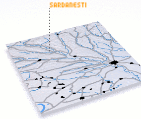 Places with similar names to Sărdăneşti, Romania ::
// Sărdăneşti (RO)
Disclaimer :: Information on this page comes without warranty of any kind |
||
|
Where is Sărdăneşti? Elevation and coordinates ::
Latitude (lat): 44°46'0"N Longitude (lon): 23°22'0"E
Elevation (approx.): 159m (map arrows pan, magnifying glasses zoom) |
||
|
Visiting Sărdăneşti? Hotel/Accommodation ::
Book a hotel in Sărdăneşti Travel Guide ::
Buy a travel guide for Romania rental cars ::
car rental offers GPS waypoint ::
download a GPX waypoint (PoI) of Sărdăneşti for your GPS receiver
|
||