|
search place name
|
||
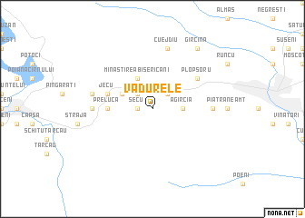
Vădurele (Covurlui, Romania)Vădurele is a town in the Covurlui region of Romania. An overview map of the region around Vădurele is displayed below.
regional and 3d topo map of Vădurele, Romania ::
Vădurele airports ::
The nearest airport is BCM - Bacau, located 66.9 km south east of Vădurele.
Other airports nearby include SCV - Suceava Stefan Cel Mare (86.1 km north), IAS - Iasi (108.1 km east), TGM - Tirgu Mures Vidrasau (149.1 km west), Nearby towns ::
Secu (1.3km west) //
Vaduri (1.3km west) //
După Deal (2.2km north east) //
Strîmtura (2.2km north west) //
Scăricica (2.2km north west) //
Mîliciu (2.2km north east) //
Malici (2.2km north east) //
Viişoara (2.2km north west) //
Bisericani (2.2km north east) //
Agîrcia (2.5km east) //
Pîngărăciori (3.1km north west) //
Mînăstirea Bisericani (3.9km north) //
Preluca (3.8km west) //
Niţeni (3.8km west) //
Poiana (3.8km west) //
Jecu (4.2km north west) //
Bistriţa (5.3km north east) //
Plopşoru (5.3km north east) //
Doamna (5.1km east) //
Oanţu (5.1km west) //
Cuejdiu (7.5km north) //
Gura Oanţului (5.4km west) //
Gîrcina (8.3km north east) //
[all distances 'as the bird flies' and approximate] 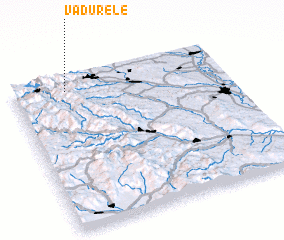 Places with similar names to Vădurele, Romania ::
Disclaimer :: Information on this page comes without warranty of any kind |
||
|
Where is Vădurele? Elevation and coordinates ::
Latitude (lat): 46°55'0"N Longitude (lon): 26°15'0"E
Elevation (approx.): 623m (map arrows pan, magnifying glasses zoom) |
||
|
Visiting Vădurele? Hotel/Accommodation ::
Book a hotel in Vădurele Travel Guide ::
Buy a travel guide for Romania rental cars ::
car rental offers GPS waypoint ::
download a GPX waypoint (PoI) of Vădurele for your GPS receiver
|
||