|
search place name
|
||
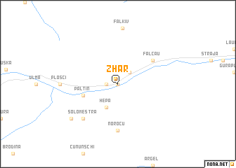
Zhar (Covurlui, Romania)Zhar is a town in the Covurlui region of Romania. An overview map of the region around Zhar is displayed below.
regional and 3d topo map of Zhar, Romania ::
Zhar airports ::
The nearest airport is SCV - Suceava Stefan Cel Mare, located 73.5 km east of Zhar.
Other airports nearby include BAY - Baia Mare Tautii Magheraus (148.0 km west), TGM - Tirgu Mures Vidrasau (174.8 km south west), CLJ - Cluj-napoca Cluj Napoca (178.9 km south west), BCM - Bacau (189.0 km south east), Nearby towns ::
Brodina (0.0km north) //
Brodina de Jos (0.0km north) //
Cornu (0.0km north) //
Dubiovşcha (0.0km north) //
Tubinsca (0.0km north) //
Roşusnei (0.0km north) //
Sadău (1.2km west) //
Frasin (2.2km north east) //
Hepa (3.9km south) //
Paltin (4.2km south west) //
Falcău (5.3km north east) //
Norocu (7.4km south) //
Solomestra (6.7km south west) //
Fal'kiv (8.8km north) //
Ehreşte (7.5km south west) //
[all distances 'as the bird flies' and approximate] 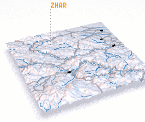 Places with similar names to Zhar, Romania ::
Disclaimer :: Information on this page comes without warranty of any kind |
||
|
Where is Zhar? Elevation and coordinates ::
Latitude (lat): 47°53'0"N Longitude (lon): 25°25'0"E
Elevation (approx.): 594m (map arrows pan, magnifying glasses zoom) |
||
|
Visiting Zhar? Hotel/Accommodation ::
Book a hotel in Zhar Travel Guide ::
Buy a travel guide for Romania rental cars ::
car rental offers GPS waypoint ::
download a GPX waypoint (PoI) of Zhar for your GPS receiver
|
||