|
search place name
|
||
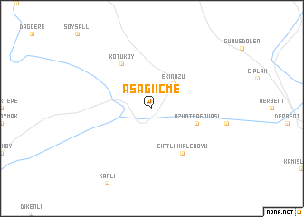
Aşağıiçme (Kahramanmaraş, Turkey)Aşağıiçme is a town in the Kahramanmaraş region of Turkey. An overview map of the region around Aşağıiçme is displayed below.
regional and 3d topo map of Aşağıiçme, Turkey ::
Aşağıiçme airports ::
The nearest airport is MLX - Malatya Erhac, located 92.4 km north east of Aşağıiçme.
Other airports nearby include GZT - Gaziantep Oguzeli (123.7 km south), ASR - Kayseri Erkilet (167.3 km north west), ADA - Adana Incirlik Ab (191.8 km south west), VAS - Sivas (199.0 km north), Nearby towns ::
Ekinözü (3.7km north east) //
Uzuntepeovası (4.8km south east) //
Çiftlikkaleköyü (6.3km south east) //
Kötüköy (6.3km north west) //
[all distances 'as the bird flies' and approximate] 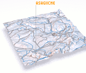 Places with similar names to Aşağıiçme, Turkey ::
// Aşağı Cuma (TR)
// Aşağıküme (TR)
Disclaimer :: Information on this page comes without warranty of any kind |
||
|
Where is Aşağıiçme? Elevation and coordinates ::
Latitude (lat): 38°2'0"N Longitude (lon): 37°10'0"E
Elevation (approx.): 1164m (map arrows pan, magnifying glasses zoom) |
||
|
Visiting Aşağıiçme? Hotel/Accommodation ::
Book a hotel in Aşağıiçme Travel Guide ::
Buy a travel guide for Turkey rental cars ::
car rental offers GPS waypoint ::
download a GPX waypoint (PoI) of Aşağıiçme for your GPS receiver
|
||