|
search place name
|
||
Bıyıkali (Tekirdağ, Turkey)Bıyıkali is a town in the Tekirdağ region of Turkey. An overview map of the region around Bıyıkali is displayed below.
regional and 3d topo map of Bıyıkali, Turkey ::

Bıyıkali airports ::
The nearest airport is BDM - Bandirma, located 92.9 km south east of Bıyıkali.
Other airports nearby include AXD - Alexandroupolis Dimokritos (120.7 km west), IST - Istanbul Ataturk (121.3 km east), BZI - Balikesir (162.1 km south), BOJ - Bourgas Burgas (172.9 km north), Nearby towns ::
Osmanlı (3.8km north) //
Hacıköy (3.8km south west) //
Seymenli (5.6km south) //
Banarlı (6.2km north west) //
Ferhadanlı (5.5km south west) //
Güvençli (6.5km south west) //
Karahisarlı (7.4km south) //
Yağcı (6.2km south east) //
Demirli (7.2km north west) //
Nusratfakı (8.8km south west) //
Nusratlı (8.9km south east) //
[all distances 'as the bird flies' and approximate] 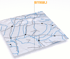 Places with similar names to Bıyıkali, Turkey ::
// Beyoğlu (TR)
// Beyoğlu (TR)
// Beyoğlu (TR)
// Bıyıklı (TR)
// Büyüklü (TR)
// Buyukly (RU)
// Būyā Qolī (IR)
// Bayou Goula (US)
// Buya-Ekole I (CD)
// Buya-Ekole II (CD)
Disclaimer :: Information on this page comes without warranty of any kind |
||
|
Where is Bıyıkali? Elevation and coordinates ::
Latitude (lat): 41°0'59"N Longitude (lon): 27°22'24"E
Elevation (approx.): 219m (map arrows pan, magnifying glasses zoom) |
||
|
Visiting Bıyıkali? Hotel/Accommodation ::
Book a hotel in Bıyıkali Travel Guide ::
Buy a travel guide for Turkey rental cars ::
car rental offers GPS waypoint ::
download a GPX waypoint (PoI) of Bıyıkali for your GPS receiver
|
||