|
search place name
|
||
Bornova (İzmir, Turkey)Bornova is a town in the İzmir region of Turkey. An overview map of the region around Bornova is displayed below.
regional and 3d topo map of Bornova, Turkey ::

Bornova airports ::
The nearest airport is IGL - Izmir Cigli, located 19.0 km west of Bornova.
Other airports nearby include ADB - Izmir Adnan Menderes (20.5 km south), MJT - Mytilini Mitilini (84.7 km north west), SMI - Samos (90.7 km south), JKH - Chios (95.4 km west), Nearby towns ::
Işıklar (4.3km south) //
Çamiçi (5.3km north) //
Naldöken (4.3km south east) //
Bayrali see Bayraklı (4.8km west) //
Pınarbaşı (6.2km south east) //
Altındağ (8.0km south) //
Turan (6.6km west) //
Kavaklıdere (7.0km east) //
İzmir (9.3km south west) //
Sarnıç (9.8km north east) //
Beşyol (9.6km north east) //
[all distances 'as the bird flies' and approximate] 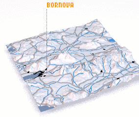 Places with similar names to Bornova, Turkey ::
// Baranof (US)
// Bairro Novo (PT)
// Baranava (LT)
// Barrio Nuevo (CU)
// Beronovo (BG)
// Borinovo (BG)
// Branevo (BG)
// Buranovo (BG)
// Brunava (LV)
// Bîrnova (RO)
Disclaimer :: Information on this page comes without warranty of any kind |
||
|
Where is Bornova? Elevation and coordinates ::
Latitude (lat): 38°28'11"N Longitude (lon): 27°13'16"E
Elevation (approx.): 71m (map arrows pan, magnifying glasses zoom) |
||
|
Visiting Bornova? Hotel/Accommodation ::
Book a hotel in Bornova Travel Guide ::
Buy a travel guide for Turkey rental cars ::
car rental offers GPS waypoint ::
download a GPX waypoint (PoI) of Bornova for your GPS receiver
|
||