|
search place name
|
||
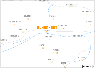
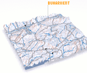
Buharkent (Aydın, Turkey)Buharkent is a town in the Aydın region of Turkey. An overview map of the region around Buharkent is displayed below.
regional and 3d topo map of Buharkent, Turkey ::
Buharkent airports ::
The nearest airport is DNZ - Denizli Cardak, located 85.7 km east of Buharkent.
Other airports nearby include DLM - Dalaman (137.3 km south), ADB - Izmir Adnan Menderes (144.8 km west), SMI - Samos (164.4 km west), IGL - Izmir Cigli (164.7 km north west), Nearby towns ::
 Places with similar names to Buharkent, Turkey ::
// Bāhārkāndi (BD)
// Baherākāndi (BD)
// Behārkandi (BD)
// Bhuārkāndi (BD)
// Bhurkunda (IN)
// Bhurkundi (IN)
Disclaimer :: Information on this page comes without warranty of any kind |
||
|
Where is Buharkent? Elevation and coordinates ::
Latitude (lat): 37°57'0"N Longitude (lon): 28°45'0"E
Elevation (approx.): 132m (map arrows pan, magnifying glasses zoom) |
||
|
Visiting Buharkent? Hotel/Accommodation ::
Book a hotel in Buharkent Travel Guide ::
Buy a travel guide for Turkey rental cars ::
car rental offers GPS waypoint ::
download a GPX waypoint (PoI) of Buharkent for your GPS receiver
|
||