|
search place name
|
||
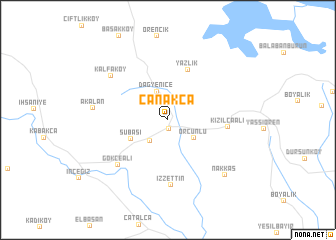
Çanakça (İstanbul, Turkey)Çanakça is a town in the İstanbul region of Turkey. An overview map of the region around Çanakça is displayed below.
regional and 3d topo map of Çanakça, Turkey ::
Çanakça airports ::
The nearest airport is IST - Istanbul Ataturk, located 40.1 km south east of Çanakça.
Other airports nearby include BDM - Bandirma (112.0 km south west), BOJ - Bourgas Burgas (168.0 km north west), BZI - Balikesir (187.0 km south), VAR - Varna (227.5 km north), Nearby towns ::
Kestanelik (1.0km south) //
Oklalı (2.8km south west) //
Dağyenice (3.3km north) //
Örcünlü (3.0km south east) //
Subaşı (3.7km south west) //
Yazlık (5.8km north) //
Kızılcaali (5.1km east) //
İzzettin (7.3km south) //
Gökçeali (6.5km south west) //
Kalfaköy (6.8km north west) //
Akalan (6.4km west) //
Nakkaş (7.8km south east) //
[all distances 'as the bird flies' and approximate] 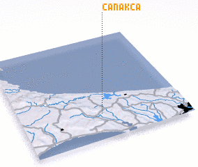 Places with similar names to Çanakça, Turkey ::
Disclaimer :: Information on this page comes without warranty of any kind |
||
|
Where is Çanakça? Elevation and coordinates ::
Latitude (lat): 41°14'46"N Longitude (lon): 28°29'48"E
Elevation (approx.): 46m (map arrows pan, magnifying glasses zoom) |
||
|
Visiting Çanakça? Hotel/Accommodation ::
Book a hotel in Çanakça Travel Guide ::
Buy a travel guide for Turkey rental cars ::
car rental offers GPS waypoint ::
download a GPX waypoint (PoI) of Çanakça for your GPS receiver
|
||