|
search place name
|
||
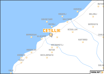
Çetillik (Hatay, Turkey)Çetillik is a town in the Hatay region of Turkey. An overview map of the region around Çetillik is displayed below.
regional and 3d topo map of Çetillik, Turkey ::
Çetillik airports ::
The nearest airport is ADA - Adana Incirlik Ab, located 78.4 km north west of Çetillik.
Other airports nearby include ADA - Adana (84.7 km north west), LTK - Latakia Bassel Al Assad Intl (112.7 km south), ALP - Aleppo Intl (120.3 km east), GZT - Gaziantep Oguzeli (151.5 km north east), Nearby towns ::
Karagöz (1.5km east) //
Akçalı (3.7km north) //
Gözcüler (3.7km south) //
Uluçınar (3.0km west) //
Hacıahmetli (4.0km south) //
Hüyük (5.6km south) //
Gökmeydan (5.8km north) //
Arpagedik (6.0km west) //
Üçgüllük (6.2km east) //
Avcılarsuyu (7.6km south) //
Gülcihan (7.1km north east) //
Madenli (8.0km north) //
Maraşlar (8.2km south west) //
[all distances 'as the bird flies' and approximate] 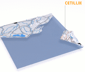 Places with similar names to Çetillik, Turkey ::
Disclaimer :: Information on this page comes without warranty of any kind |
||
|
Where is Çetillik? Elevation and coordinates ::
Latitude (lat): 36°25'0"N Longitude (lon): 35°55'0"E
Elevation (approx.): 17m (map arrows pan, magnifying glasses zoom) |
||
|
Visiting Çetillik? Hotel/Accommodation ::
Book a hotel in Çetillik Travel Guide ::
Buy a travel guide for Turkey rental cars ::
car rental offers GPS waypoint ::
download a GPX waypoint (PoI) of Çetillik for your GPS receiver
|
||