|
search place name
|
||
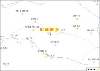
Dağkonak (Turkey)Dağkonak is a town in Turkey. An overview map of the region around Dağkonak is displayed below.
regional and 3d topo map of Dağkonak, Turkey ::
Dağkonak airports ::
The nearest airport is VAN - Van, located 131.7 km north east of Dağkonak.
Other airports nearby include BAL - Batman (132.8 km north west), Nearby towns ::
Geçitbayır (2.0km north) //
Araköy (2.1km east) //
Üçkiraz (3.8km south east) //
Hatipler (3.3km east) //
Balveren (3.4km east) //
Altınkuşak (4.1km east) //
Yoğurtçular (5.6km north west) //
Kemerli (7.0km south) //
Cevizdüzü (5.9km south west) //
Odabası (7.1km south) //
Bozçalı (6.1km west) //
Şirnak (6.8km north west) //
Ağıt (6.6km south west) //
Boyunyaka (8.3km south) //
Anılmış (8.6km south) //
[all distances 'as the bird flies' and approximate]  Places with similar names to Dağkonak, Turkey ::
// Dikgang (ZA)
// Tokoï-Goungou (BJ)
// Dougakongo (ML)
// Dégagnac (FR)
// Ta-kuei-k'eng (TW)
// Tikogaing (MM)
// Dục Quang (VN)
Disclaimer :: Information on this page comes without warranty of any kind |
||
|
Where is Dağkonak? Elevation and coordinates ::
Latitude (lat): 37°28'34"N Longitude (lon): 42°30'36"E
Elevation (approx.): 1166m (map arrows pan, magnifying glasses zoom) |
||
|
Visiting Dağkonak? Hotel/Accommodation ::
Book a hotel in Dağkonak Travel Guide ::
Buy a travel guide for Turkey rental cars ::
car rental offers GPS waypoint ::
download a GPX waypoint (PoI) of Dağkonak for your GPS receiver
|
||