|
search place name
|
||
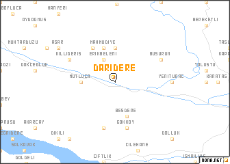
Darıdere (Tokat, Turkey)Darıdere is a town in the Tokat region of Turkey. An overview map of the region around Darıdere is displayed below.
regional and 3d topo map of Darıdere, Turkey ::
Darıdere airports ::
The nearest airport is VAS - Sivas, located 72.4 km south of Darıdere.
Other airports nearby include MZH - Merzifon (145.9 km west), ASR - Kayseri Erkilet (233.9 km south west), MLX - Malatya Erhac (235.7 km south), Nearby towns ::
Erikbeleni (4.0km north) //
Mutluca (4.2km west) //
Dağüstü (5.6km north) //
Beşdere (5.7km south) //
Mahmudiye (5.7km north) //
Yazıcık (6.2km north west) //
Gökköy (7.5km south) //
Durudere (7.5km south) //
Büşürüm (6.8km north east) //
Kıllıgeriş (6.8km north west) //
[all distances 'as the bird flies' and approximate] 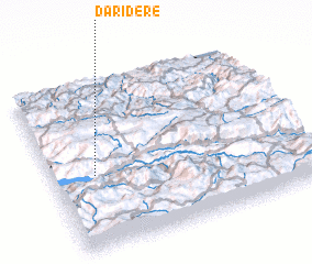 Places with similar names to Darıdere, Turkey ::
// Taratara (BO)
// Dar Dar (MA)
// Dardara (MA)
// Douar Drâa (MA)
// Douar Draaoua (MA)
// Tiratira (BO)
// Torotoro (BO)
// Tretiy Yar (RU)
// Tǝrtǝr (AZ)
// Dardara (PH)
Disclaimer :: Information on this page comes without warranty of any kind |
||
|
Where is Darıdere? Elevation and coordinates ::
Latitude (lat): 40°26'0"N Longitude (lon): 37°10'0"E
Elevation (approx.): 778m (map arrows pan, magnifying glasses zoom) |
||
|
Visiting Darıdere? Hotel/Accommodation ::
Book a hotel in Darıdere Travel Guide ::
Buy a travel guide for Turkey rental cars ::
car rental offers GPS waypoint ::
download a GPX waypoint (PoI) of Darıdere for your GPS receiver
|
||