|
search place name
|
||
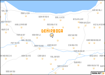
Demirboğa (Bursa, Turkey)Demirboğa is a town in the Bursa region of Turkey. An overview map of the region around Demirboğa is displayed below.
regional and 3d topo map of Demirboğa, Turkey ::
Demirboğa airports ::
The nearest airport is IST - Istanbul Ataturk, located 97.1 km north west of Demirboğa.
Other airports nearby include ESK - Eskisehir (104.9 km south east), BDM - Bandirma (135.1 km west), BZI - Balikesir (160.1 km south west), AFY - Afyon (197.7 km south east), Nearby towns ::
Yıldırım (1.9km north) //
Burçın (1.6km south east) //
Süleymaniye (3.4km north west) //
Reşadiye (3.7km north) //
Karaköy (3.7km south) //
Kirazlıyayla (4.7km north east) //
Kavaklı (4.2km west) //
Menteşe (5.2km south west) //
Göllüce (6.5km north) //
Demirışık (6.9km north) //
Kozdere (5.6km east) //
Yolören (7.8km south) //
Cihadiye (6.8km south east) //
Çardak (7.9km south) //
[all distances 'as the bird flies' and approximate] 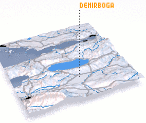 Places with similar names to Demirboğa, Turkey ::
// Tamurbek (RU)
// Temirbaga (RU)
// Demirboğa (TR)
// Temirbek (KZ)
// Tamer Beyg (IR)
// Diambèrèbougou (ML)
// Tamarbek (PG)
Disclaimer :: Information on this page comes without warranty of any kind |
||
|
Where is Demirboğa? Elevation and coordinates ::
Latitude (lat): 40°19'0"N Longitude (lon): 29°34'0"E
Elevation (approx.): 386m (map arrows pan, magnifying glasses zoom) |
||
|
Visiting Demirboğa? Hotel/Accommodation ::
Book a hotel in Demirboğa Travel Guide ::
Buy a travel guide for Turkey rental cars ::
car rental offers GPS waypoint ::
download a GPX waypoint (PoI) of Demirboğa for your GPS receiver
|
||