|
search place name
|
||
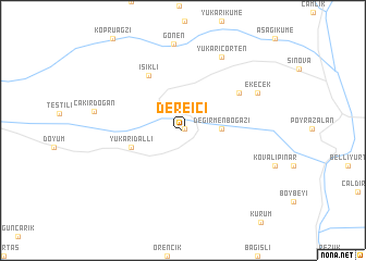
Dereiçi (Van, Turkey)Dereiçi is a town in the Van region of Turkey. An overview map of the region around Dereiçi is displayed below.
regional and 3d topo map of Dereiçi, Turkey ::
Dereiçi airports ::
The nearest airport is VAN - Van, located 88.3 km north west of Dereiçi.
Nearby towns ::
Keçilioba (0.2km north east) //
Değirmenboğazı (3.1km east) //
Akçalı (4.6km west) //
Yukarıdallı (4.6km west) //
Işıklı (6.3km north west) //
Belencik (6.0km north east) //
Yukarıçörten (8.1km north) //
Ekecek (7.1km north east) //
[all distances 'as the bird flies' and approximate] 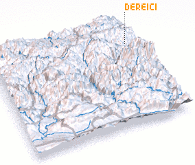 Places with similar names to Dereiçi, Turkey ::
// Douar ez Zaouia (MA)
// Douar Zaouia (MA)
// Tarasa (RU)
// Tarasy (RU)
// Tarasy (RU)
// Tarusa (RU)
// Tarusy (RU)
// Terasy (RU)
// Torres (BO)
// Torrez (BO)
Disclaimer :: Information on this page comes without warranty of any kind |
||
|
Where is Dereiçi? Elevation and coordinates ::
Latitude (lat): 37°50'56"N Longitude (lon): 43°57'53"E
Elevation (approx.): 2132m (map arrows pan, magnifying glasses zoom) |
||
|
Visiting Dereiçi? Hotel/Accommodation ::
Book a hotel in Dereiçi Travel Guide ::
Buy a travel guide for Turkey rental cars ::
car rental offers GPS waypoint ::
download a GPX waypoint (PoI) of Dereiçi for your GPS receiver
|
||