|
search place name
|
||
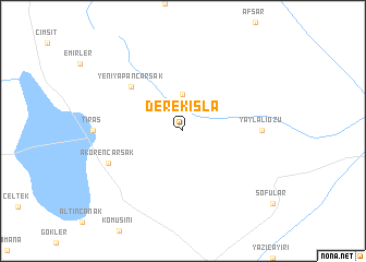
Derekışla (Turkey)Derekışla is a town in Turkey. An overview map of the region around Derekışla is displayed below.
regional and 3d topo map of Derekışla, Turkey ::
Derekışla airports ::
The nearest airport is ANK - Ankara Etimesgut, located 72.3 km north west of Derekışla.
Other airports nearby include ESB - Ankara Esenboga (86.4 km north), KYA - Konya (157.3 km south), Nearby towns ::
Hanburun (3.7km north) //
Yeniyapançarşak (6.1km north west) //
Yaylalıözü (6.3km east) //
Akörençarsak (6.7km south west) //
[all distances 'as the bird flies' and approximate] 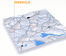 Places with similar names to Derekışla, Turkey ::
// Tarkasale (RU)
// Tarko-Sale (RU)
// Drexel (US)
// Troxel (US)
// Ytre Okslia (NO)
// Drogosław (PL)
// Drogosław (PL)
// Drogosław (PL)
// Tirkšliai (LT)
// Trakšeliai (LT)
Disclaimer :: Information on this page comes without warranty of any kind |
||
|
Where is Derekışla? Elevation and coordinates ::
Latitude (lat): 39°21'0"N Longitude (lon): 33°1'0"E
Elevation (approx.): 1005m (map arrows pan, magnifying glasses zoom) |
||
|
Visiting Derekışla? Hotel/Accommodation ::
Book a hotel in Derekışla Travel Guide ::
Buy a travel guide for Turkey rental cars ::
car rental offers GPS waypoint ::
download a GPX waypoint (PoI) of Derekışla for your GPS receiver
|
||