|
search place name
|
||
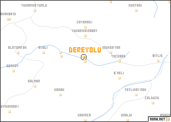
Dereyolu (Bitlis, Turkey)Dereyolu is a town in the Bitlis region of Turkey. An overview map of the region around Dereyolu is displayed below.
regional and 3d topo map of Dereyolu, Turkey ::
Dereyolu airports ::
The nearest airport is BAL - Batman, located 91.0 km south west of Dereyolu.
Other airports nearby include VAN - Van (119.5 km east), DIY - Diyabakir Diyarbakir (164.6 km west), ERZ - Erzurum (186.0 km north), Nearby towns ::
Kömüryakan (0.0km north) //
Mutki (4.3km west) //
Yukarıkaraboy (5.6km north) //
Çatalsöğüt (4.7km north west) //
Konuksayar (4.7km north east) //
Yücebaş (5.8km east) //
Çayarası (7.4km north) //
İçmeli (6.9km south east) //
Kaşak (8.6km south west) //
[all distances 'as the bird flies' and approximate]  Places with similar names to Dereyolu, Turkey ::
// Tarryall (US)
// Dereyayla (TR)
// Dereyolu (TR)
// Taryāla (PK)
// Taeryŏl-li (KP)
// Toryŏul (KP)
// Toryul-li (KP)
// Taeryŏl-li (KR)
// Taeryul (KR)
// Tryall (JM)
Disclaimer :: Information on this page comes without warranty of any kind |
||
|
Where is Dereyolu? Elevation and coordinates ::
Latitude (lat): 38°24'0"N Longitude (lon): 41°58'0"E
Elevation (approx.): 1713m (map arrows pan, magnifying glasses zoom) |
||
|
Visiting Dereyolu? Hotel/Accommodation ::
Book a hotel in Dereyolu Travel Guide ::
Buy a travel guide for Turkey rental cars ::
car rental offers GPS waypoint ::
download a GPX waypoint (PoI) of Dereyolu for your GPS receiver
|
||