|
search place name
|
||
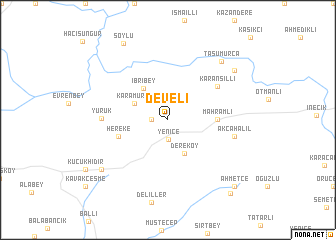
Develi (Tekirdağ, Turkey)Develi is a town in the Tekirdağ region of Turkey. An overview map of the region around Develi is displayed below.
regional and 3d topo map of Develi, Turkey ::
Develi airports ::
The nearest airport is BDM - Bandirma, located 98.9 km south east of Develi.
Other airports nearby include AXD - Alexandroupolis Dimokritos (99.6 km west), IST - Istanbul Ataturk (141.6 km east), BZI - Balikesir (160.7 km south east), BOJ - Bourgas Burgas (184.5 km north), Nearby towns ::
Kermeyan (1.4km west) //
Yenice (2.2km south) //
Karamurat (3.4km north west) //
Dereköy (4.0km south) //
İbribey (4.1km north west) //
Mahramlı (4.2km east) //
Hereke (4.6km south west) //
Karansıllı (5.6km north east) //
Yürük (5.6km west) //
Akçahalil (5.9km east) //
Taşumurca (8.0km north east) //
Ahievren (7.9km south west) //
Selçuk (7.9km north east) //
Generli (7.9km north east) //
Soylu (9.4km north west) //
Ahmetçe (9.3km south east) //
Yuva (9.7km south east) //
[all distances 'as the bird flies' and approximate] 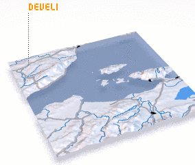 Places with similar names to Develi, Turkey ::
Disclaimer :: Information on this page comes without warranty of any kind |
||
|
Where is Develi? Elevation and coordinates ::
Latitude (lat): 40°56'0"N Longitude (lon): 27°8'0"E
Elevation (approx.): 208m (map arrows pan, magnifying glasses zoom) |
||
|
Visiting Develi? Hotel/Accommodation ::
Book a hotel in Develi Travel Guide ::
Buy a travel guide for Turkey rental cars ::
car rental offers GPS waypoint ::
download a GPX waypoint (PoI) of Develi for your GPS receiver
|
||