|
search place name
|
||
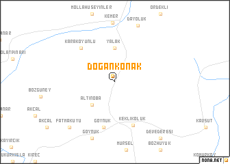
Doğankonak (Kayseri, Turkey)Doğankonak is a town in the Kayseri region of Turkey. An overview map of the region around Doğankonak is displayed below.
regional and 3d topo map of Doğankonak, Turkey ::
Doğankonak airports ::
The nearest airport is ASR - Kayseri Erkilet, located 99.1 km north west of Doğankonak.
Other airports nearby include MLX - Malatya Erhac (146.1 km east), ADA - Adana Incirlik Ab (166.1 km south west), GZT - Gaziantep Oguzeli (173.1 km south east), ADA - Adana (175.2 km south west), Nearby towns ::
Altınoba (4.7km south west) //
Yalak (5.6km north) //
Göynük (7.6km south) //
Keklikoluk (7.5km south) //
Karakoyunlu (7.1km north west) //
Fatmakuyu (9.4km south west) //
[all distances 'as the bird flies' and approximate] 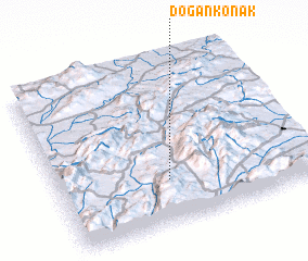 Places with similar names to Doğankonak, Turkey ::
// Tagaung-aing (MM)
// Taiqinggong (CN)
Disclaimer :: Information on this page comes without warranty of any kind |
||
|
Where is Doğankonak? Elevation and coordinates ::
Latitude (lat): 38°16'0"N Longitude (lon): 36°26'0"E
Elevation (approx.): 1552m (map arrows pan, magnifying glasses zoom) |
||
|
Visiting Doğankonak? Hotel/Accommodation ::
Book a hotel in Doğankonak Travel Guide ::
Buy a travel guide for Turkey rental cars ::
car rental offers GPS waypoint ::
download a GPX waypoint (PoI) of Doğankonak for your GPS receiver
|
||