|
search place name
|
||
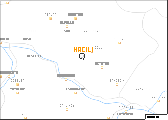
Hacılı (Turkey)Hacılı is a town in Turkey. An overview map of the region around Hacılı is displayed below.
regional and 3d topo map of Hacılı, Turkey ::
Hacılı airports ::
The nearest airport is TZX - Trabzon, located 59.6 km north east of Hacılı.
Other airports nearby include ERC - Erzincan (87.7 km south), ERZ - Erzurum (153.1 km south east), EZS - Elazig (211.1 km south), Nearby towns ::
Kalaycıoğlu (2.3km north east) //
Aktutan (3.5km south east) //
Yağlıdere (5.7km north) //
Gümüşhane (5.3km south west) //
Son (6.2km north west) //
Eskibağlar (7.5km south) //
Alpullu (7.9km north) //
Olucak (7.2km north east) //
Bahçecik (7.9km south east) //
[all distances 'as the bird flies' and approximate] 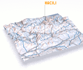 Places with similar names to Hacılı, Turkey ::
Disclaimer :: Information on this page comes without warranty of any kind |
||
|
Where is Hacılı? Elevation and coordinates ::
Latitude (lat): 40°30'0"N Longitude (lon): 39°31'0"E
Elevation (approx.): 1627m (map arrows pan, magnifying glasses zoom) |
||
|
Visiting Hacılı? Hotel/Accommodation ::
Book a hotel in Hacılı Travel Guide ::
Buy a travel guide for Turkey rental cars ::
car rental offers GPS waypoint ::
download a GPX waypoint (PoI) of Hacılı for your GPS receiver
|
||