|
search place name
|
||
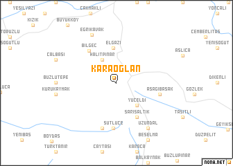
Karaoğlan (Tunceli, Turkey)Karaoğlan is a town in the Tunceli region of Turkey. An overview map of the region around Karaoğlan is displayed below.
regional and 3d topo map of Karaoğlan, Turkey ::
Karaoğlan airports ::
The nearest airport is ERC - Erzincan, located 59.2 km north east of Karaoğlan.
Other airports nearby include EZS - Elazig (69.7 km south), MLX - Malatya Erhac (132.1 km south west), DIY - Diyabakir Diyarbakir (171.4 km south east), ERZ - Erzurum (185.7 km north east), Nearby towns ::
Aktaş (3.2km north east) //
Halitpınar (4.2km north west) //
Yüceldi (4.4km south east) //
Elgazi (5.6km north) //
Sarısaltık (6.0km south east) //
Bilgeç (6.2km north west) //
Aşağıbaşak (5.7km east) //
Sütlüce (7.4km south) //
Akören (7.6km south) //
Eğrikavak (8.4km north) //
Uzundal (8.3km south east) //
[all distances 'as the bird flies' and approximate] 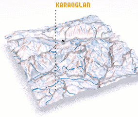 Places with similar names to Karaoğlan, Turkey ::
// Kǝrgǝlan (AZ)
// Qaraoğlan (AZ)
// Qaraoğlan (AZ)
// Kirklin (US)
// Corigliano (IT)
// Garigliano (IT)
// Garigliano (IT)
// Korkliny (PL)
// Kruklin (PL)
// Grigaliūnai (LT)
Disclaimer :: Information on this page comes without warranty of any kind |
||
|
Where is Karaoğlan? Elevation and coordinates ::
Latitude (lat): 39°13'58"N Longitude (lon): 39°13'15"E
Elevation (approx.): 1875m (map arrows pan, magnifying glasses zoom) |
||
|
Visiting Karaoğlan? Hotel/Accommodation ::
Book a hotel in Karaoğlan Travel Guide ::
Buy a travel guide for Turkey rental cars ::
car rental offers GPS waypoint ::
download a GPX waypoint (PoI) of Karaoğlan for your GPS receiver
|
||