|
search place name
|
||
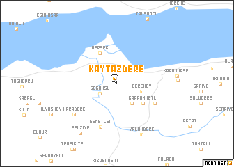
Kaytazdere (Yalova, Turkey)Kaytazdere is a town in the Yalova region of Turkey. An overview map of the region around Kaytazdere is displayed below.
regional and 3d topo map of Kaytazdere, Turkey ::
Kaytazdere airports ::
The nearest airport is IST - Istanbul Ataturk, located 68.8 km north west of Kaytazdere.
Other airports nearby include ESK - Eskisehir (133.8 km south east), BDM - Bandirma (137.4 km west), BZI - Balikesir (180.2 km south west), AFY - Afyon (235.4 km south east), Nearby towns ::
Altınova (2.6km north west) //
Soğuksu (2.6km south west) //
İnebeyli (3.6km south east) //
Dereköy (3.3km south east) //
Karaahmetli (4.5km south east) //
Hersek (5.3km north west) //
Hayriye (5.6km south east) //
Semetler (7.3km south) //
Karadere (7.2km south west) //
Yalakdere (8.7km south) //
Fevziye (9.1km south west) //
[all distances 'as the bird flies' and approximate]  Places with similar names to Kaytazdere, Turkey ::
// Gottstreu (DE)
// Guty Stare (PL)
// Kąty Stare (PL)
// Kidds Store (US)
// Qowd-e Azhdar (IR)
// Kot Sattār (PK)
// Good Easter (GB)
Disclaimer :: Information on this page comes without warranty of any kind |
||
|
Where is Kaytazdere? Elevation and coordinates ::
Latitude (lat): 40°40'42"N Longitude (lon): 29°31'43"E
Elevation (approx.): 83m (map arrows pan, magnifying glasses zoom) |
||
|
Visiting Kaytazdere? Hotel/Accommodation ::
Book a hotel in Kaytazdere Travel Guide ::
Buy a travel guide for Turkey rental cars ::
car rental offers GPS waypoint ::
download a GPX waypoint (PoI) of Kaytazdere for your GPS receiver
|
||