|
search place name
|
||
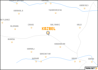
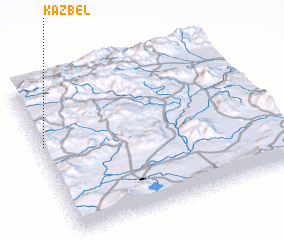
Kazbel (Erzurum, Turkey)Kazbel is a town in the Erzurum region of Turkey. An overview map of the region around Kazbel is displayed below.
regional and 3d topo map of Kazbel, Turkey ::
Kazbel airports ::
The nearest airport is ERZ - Erzurum, located 82.7 km north west of Kazbel.
Other airports nearby include VAN - Van (169.2 km south east), BAL - Batman (200.2 km south west), DIY - Diyabakir Diyarbakir (245.5 km south west), Nearby towns ::
 Places with similar names to Kazbel, Turkey ::
// Casabula (PH)
// Gaisbühl (DE)
// Gaisbühl (DE)
// Gaisbühl (DE)
// Gaisbühl (DE)
// Casa Bella (US)
// Casabella (IT)
// Casa Bullo (IT)
// Cassibile (IT)
// Gåsbøl (NO)
Disclaimer :: Information on this page comes without warranty of any kind |
||
|
Where is Kazbel? Elevation and coordinates ::
Latitude (lat): 39°35'28"N Longitude (lon): 42°0'40"E
Elevation (approx.): 2101m (map arrows pan, magnifying glasses zoom) |
||
|
Visiting Kazbel? Hotel/Accommodation ::
Book a hotel in Kazbel Travel Guide ::
Buy a travel guide for Turkey rental cars ::
car rental offers GPS waypoint ::
download a GPX waypoint (PoI) of Kazbel for your GPS receiver
|
||