|
search place name
|
||
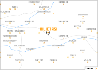
Kılıçtaşı (Turkey)Kılıçtaşı is a town in Turkey. An overview map of the region around Kılıçtaşı is displayed below.
regional and 3d topo map of Kılıçtaşı, Turkey ::
Kılıçtaşı airports ::
The nearest airport is ERC - Erzincan, located 51.4 km south of Kılıçtaşı.
Other airports nearby include TZX - Trabzon (102.7 km north east), ERZ - Erzurum (159.5 km east), EZS - Elazig (170.6 km south), MLX - Malatya Erhac (217.1 km south west), Nearby towns ::
Başpınar (3.3km south west) //
Doğanca (2.9km west) //
Dereyüzü (4.4km east) //
Gerdekhisar (5.6km south east) //
Gümüşgöze (6.1km north east) //
Sütveren (8.2km north) //
Zankarmadeni (8.3km north) //
Gökçeler (7.2km north west) //
Söğütlü (8.1km south west) //
Babakonağı (10.3km south east) //
[all distances 'as the bird flies' and approximate]  Places with similar names to Kılıçtaşı, Turkey ::
// Gałki Duże (PL)
// Gałków Duży (PL)
// Clocotici (RO)
// Clocotici (RO)
// Gulo Kats (PK)
// Kalikutes (ID)
// Calçados (BR)
// Klokotós (GR)
Disclaimer :: Information on this page comes without warranty of any kind |
||
|
Where is Kılıçtaşı? Elevation and coordinates ::
Latitude (lat): 40°8'37"N Longitude (lon): 39°19'1"E
Elevation (approx.): 1399m (map arrows pan, magnifying glasses zoom) |
||
|
Visiting Kılıçtaşı? Hotel/Accommodation ::
Book a hotel in Kılıçtaşı Travel Guide ::
Buy a travel guide for Turkey rental cars ::
car rental offers GPS waypoint ::
download a GPX waypoint (PoI) of Kılıçtaşı for your GPS receiver
|
||