|
search place name
|
||
Kızılahmet (Erzurum, Turkey)Kızılahmet is a town in the Erzurum region of Turkey. An overview map of the region around Kızılahmet is displayed below.
regional and 3d topo map of Kızılahmet, Turkey ::

Kızılahmet airports ::
The nearest airport is ERZ - Erzurum, located 100.1 km north west of Kızılahmet.
Other airports nearby include VAN - Van (153.0 km south east), BAL - Batman (158.9 km south west), DIY - Diyabakir Diyarbakir (207.8 km south west), Nearby towns ::
Yeşilyazı (2.3km north east) //
Uluçayır (4.7km south west) //
Göller (6.3km north east) //
Akçamelik (5.7km north east) //
Molladavut (6.0km east) //
Halilçavuş (6.5km north west) //
Çilçile (8.4km south) //
Bellitaş (8.6km north) //
Şahabettin (9.4km north east) //
[all distances 'as the bird flies' and approximate] 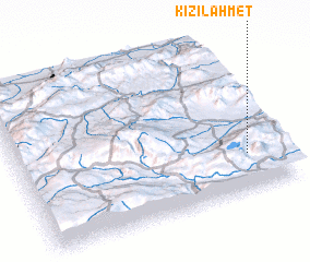 Places with similar names to Kızılahmet, Turkey ::
// Casa la Motta (IT)
// Casa la Motta (IT)
// Goz Oulmet (TD)
// Qezel Aḩmad (IR)
// Qezel Mehdī (IR)
// Cuise-la-Motte (FR)
Disclaimer :: Information on this page comes without warranty of any kind |
||
|
Where is Kızılahmet? Elevation and coordinates ::
Latitude (lat): 39°14'0"N Longitude (lon): 41°52'0"E
Elevation (approx.): 1973m (map arrows pan, magnifying glasses zoom) |
||
|
Visiting Kızılahmet? Hotel/Accommodation ::
Book a hotel in Kızılahmet Travel Guide ::
Buy a travel guide for Turkey rental cars ::
car rental offers GPS waypoint ::
download a GPX waypoint (PoI) of Kızılahmet for your GPS receiver
|
||