|
search place name
|
||
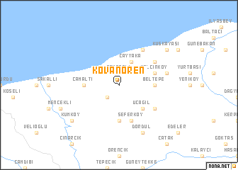
Kovanören (Kastamonu, Turkey)Kovanören is a town in the Kastamonu region of Turkey. An overview map of the region around Kovanören is displayed below.
regional and 3d topo map of Kovanören, Turkey ::
Kovanören airports ::
The nearest airport is ESB - Ankara Esenboga, located 201.2 km south of Kovanören.
Other airports nearby include ANK - Ankara Etimesgut (224.4 km south), Nearby towns ::
Toygarlı (1.9km north) //
Ağaçbükü (2.3km south west) //
Alayüz (2.3km north west) //
Denizkonak (3.3km north west) //
Çayyaka (4.0km north) //
Üçağıl (4.6km south east) //
Beltepe (4.1km east) //
Gökçeören (5.6km south) //
Çamaltı (4.1km west) //
Yalçınköy (4.5km north east) //
Seferköy (5.7km south) //
Gökçeören (5.7km south) //
Akbayır (6.2km north east) //
İshakça (5.6km south east) //
Beşevler (5.6km north east) //
Kıranlıkoz (5.8km east) //
Dördül (7.9km south) //
Kuşkayası (7.8km north east) //
Kumköy (7.8km south west) //
[all distances 'as the bird flies' and approximate] 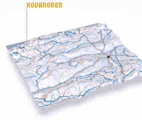 Places with similar names to Kovanören, Turkey :: Disclaimer :: Information on this page comes without warranty of any kind |
||
|
Where is Kovanören? Elevation and coordinates ::
Latitude (lat): 41°56'0"N Longitude (lon): 33°12'0"E
Elevation (approx.): 162m (map arrows pan, magnifying glasses zoom) |
||
|
Visiting Kovanören? Hotel/Accommodation ::
Book a hotel in Kovanören Travel Guide ::
Buy a travel guide for Turkey rental cars ::
car rental offers GPS waypoint ::
download a GPX waypoint (PoI) of Kovanören for your GPS receiver
|
||